History

French and Indian War Tour 2014

French and Indian War Tour MapOn September 13, 2014, Tim and I embarked on a week-long cruise of coastal Canada. Our ports of call included Halifax, Nova Scotia, Sydney, Nova Scotia, Charlottetown, Prince Edward Island, Québec City, Québec, and Montréal, Québec.

Tim called this trip our vacation; I called it our “French and Indian War Tour.”

In this post you will find information about the sites I saw during my “French and Indian War Tour.”

Tip: Did you know that you can make my photos larger by clicking on them?


Halifax, Nova Scotia

I had to make tough choices about the history sites and museums I wanted to visit during out 8.5 hours in Halifax.

In the end, I chose a full-day trip to Grand Pré and a Nova Scotia winery in the Annapolis Valley.

Located along the Bay of Fundy’s Minas Basin, Grand Pré stands as a UNESCO World Heritage Site that memorializes the Expulsion of the Acadians by the British between 1755 and 1764.

Grand PreAcadians are descended from French colonists who settled in Nova Scotia during the 1680s.

Many of the colonists established farms on the rich alluvial soils along the Bay of Fundy. The farmers constructed a system of dykes and wooden sluices to drain and protect their land from the Bay’s extreme tidal range of 40-60 feet.

Both Great Britain and France claimed sovereignty over Nova Scotia. As a result, imperial warfare caused the island to change hands several times between 1700 and 1755. Each war ended with Great Britain returning the island to France, until the French and Indian War; the Treaty of Paris 1763 ended the war and awarded Nova Scotia to the Great Britain.

Neither the French nor the British trusted the Acadians. During each war, the farmers declared neutrality. In theory, they refused to supply either army with supplies, weapons, or men. In practice, both the French and British armies extracted assistance from the Acadians by threatening their families and property holdings.

In 1755, the British officers worried that the Acadians would reverse their hard-won victory over the French Army. They feared that the Acadians would invite French soldiers to attack them and assist the French effort.

The British military lessened its fears by expelling the Acadians from Nova Scotia.

The Grand Pré World Heritage Site tells the story of the British Expulsion of the Acadians (1755-1764). Exhibit placards and a multimedia show present information about the Acadian diaspora from both Acadian and British points of view. An exhibit in the visitor center also depicts how the Acadians drained and protected their land with dykes and wooden sluices using sizable models.
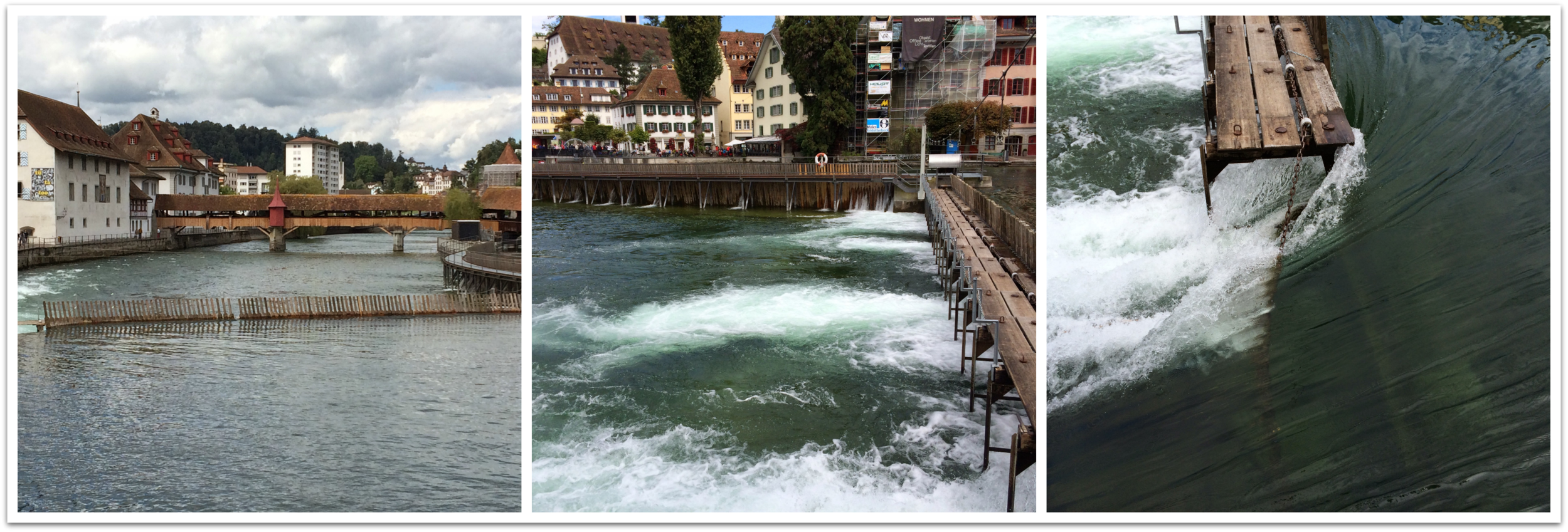
Sydney, Nova Scotia

Our stop in Sydney afforded Tim and I the opportunity to visit the most contested site in colonial North America: Fortress Louisbourg.

The Treaty of Utrecht (1713) ended Queen Anne’s War (1702-1713), but its articles did little to assuage French fears that the British might seize all of their possessions in North America. The articles awarded Great Britain all North American lands along the Atlantic seaboard with the exception of Île Royale (Cape Breton Island, Nova Scotia).

LouisbourgThe French sought to strengthen its hold of Île Royale. Between 1720 and 1740 they built a large fortress near a prosperous fishing village on the northeastern tip of the island. The French called the fortress and the settlement around it Louisbourg and they protected both with a massive stone wall.

New Englanders despised the French presence in New France. Not only were the French predominately Catholic, but between 1689 and 1713, French soldiers and Native Americans raided frontier settlements in the region. The Yankees feared that the French would use Louisbourg as an additional base from which to attack them.

In 1745, New Englanders seized the opportunity afforded by King George’s War (1744-1748) to attack Louisbourg. Against the odds, the Yankees captured the fortress and its town. However, their possession proved short-lived. In 1748 the Treaty of Aix-la-Chapelle ceded Louisbourg back to the French.

The French and Indian War rekindled British desires to reacquire Louisbourg. In 1758, a large British force laid siege to the fortress and town.

The French surrendered after 6 weeks of daily bombardment.

The 1758 surrender of Louisbourg brought forth the predictions the French government had made in 1713: the British used the fortress as a launching point for its Siege of Québec in 1759.

In 1760, the British did not know that the Treaty of Paris 1763 would uphold their possession of Île Royale. In an effort to prevent the French from retaking Louisbourg, the British blew up the fortress, town, and the thick stone walls that protected them.

The fortress and town that stand at Louisbourg today are exact reproductions of the original fortress and town buildings.

In 1960, the Canadian government commenced a project to rebuild the Fortress, some of its walls, and 1/5th of the buildings that stood within the town.

Today, Parks Canada operates Louisbourg as a living history museum. In most buildings and areas throughout Louisbourg you will find men and women dressed as 18th-century French soldiers and townsfolk. These interpreters interact with you and explain how the French colonists and soldiers lived and work.


Québec City, Québec

Our French and Indian War Tour ended on the Plains of Abraham, located in Québec City.

Established in 1608 by Samuel de Champlain, Québec City stands as one of the oldest European settlements in North America.

QuebecIn 1985, UNESCO declared the Historic District of Old Québec to be a World Heritage Site in an effort to protect the remains of the stone walls that once protected the city.

The Plains of Abraham lie just outside of these walls.

The 1759 British Siege of Québec climaxed with a Battle on the Plains of Abraham.

The battle took place on September 13, 1759 and lasted about 30 minutes.

General James Wolfe and his 4,800-man British army fought General Louis-Joseph de Montcalm and his 2,000-man French army. Both generals fought on the field and both received mortal wounds.

Wolfe’s army won.

The British victory did not end the French and Indian War, but it ended the British quest for dominance in North America.

Wolfe’s victory brought New France under British control, a fact which the Treaty of Paris 1763 confirmed and maintained.

In the early 1900s, the Canadian government established the Plains of Abraham as its first national park. Today, Parks Canada administers this grand park, which provides Québec’s urban populace with museums, gardens, and outdoor recreational space.

Monuments and memorials recounting and commemorating events that took place during the 1759 battle dot the landscape.

Tim and I spent several hours walking through the park. We found where Wolfe received his mortal wound and the monument that commemorates the place where he died. We also walked along the cliffside boardwalk.

Peering over Québec's cliffs gave me a new appreciation for the efforts Wolfe and his men exerted when they scaled them 255 years ago.


Charlottetown, Prince Edward Island

In between our stops in Sydney and Québec City, our ship docked at Charlottetown, Prince Edward Island.

In addition to taking a scenic drive and visiting the Anne of Green Gables House, Tim and I walked around Charlottetown where we found Province House, the birthplace of the Confederation of Canada.

PEIIn 1864, the political leaders of Prince Edward Island invited representatives from Canada’s maritime provinces to Charlottetown to discuss forming a confederation of the Canadian maritime provinces. Representatives from the mainland heard about this meeting and invited themselves to it.

In September 1864, twenty-three political leaders from Prince Edward Island, Nova Scotia, New Brunswick, Ontario, and Québec gathered in Charlottetown to discuss what forming a confederated and united Canadian government might look like and mean for the British colonies.

Three years later, on July 1, 1867, Parliament passed the British North America Act. Queen Victoria signed the act and the Dominion of Canada was born.

I had no idea that my visit to Prince Edward Island would lead me to the birthplace of Canadian Confederation. Although the Province House did not fit within my French and Indian War-themed tour, it provided a nice epilogue to it.

The Province House museum and site tells the story of how Canada evolved from a group of British colonies to a united, independent nation.


Conclusion

Tim and I enjoyed our cruise through coastal Canada and down the St. Lawrence River. Our brief 6-8 hour stops in Nova Scotia, PEI, and Québec introduced us to the history and natural beauty of these provinces. Some day we hope to return and spend more time exploring them.


Share Your Story

What was the last historic site you visited? 


Secret Swiss Bunker: Fortress Fürigen through Google Glass

Fortress FürigenOn Sunday, August 24, 2014, Tim and I visited Fortress Fürigen (Festung Fürigen) in Stansstad, Switzerland. The fortress used to be a part of the secret Swiss defense system of bunkers and fortresses, which the government used during World War II and the Cold War.

Today, you can visit Fortress Fürigen as a museum.

In this post you will find a brief history of Fortress Fürigen as well as a video that tours the interior of the bunker, which I took with Google Glass.


Brief History of the Fortress

From the outside we nearly missed Fortress Fürigen, which is concealed inside a rock face overlooking Lake Luzern. We entered the fortress from a camouflaged wooden shed that thankfully had a large, red open flag flying outside of it; without the flag we might have walked passed and missed it.

In 1941, the Swiss built a series of bunkers like Fortress Fürigen to combat a Nazi invasion. The invasion plan called for the Swiss government to fall back to a secret bunker at Brünig in the Berner Oberland, and for the Swiss troops to fall back from the border regions into alpine strongholds like Fürigen.

The Swiss built Fortress Fürigen to protect roads and rail lines that led from Luzern and Zürich into the Berner Oberland. Fürigen stands as a small example of a hidden Swiss fortress as it could house and feed only about 100 people for three weeks.

After World War II, the Swiss renovated its fortresses to defend against the Soviet Union and nuclear war. When the Cold War ended in 1990, the government decommissioned Fortress Fürigen and opened it as a museum.

The fortress extends 200 yards inside the mountain. The tour includes the troops’ living and dining quarters, an ammunition room, sickbay, and two concealed gun rooms.


Google Glass and Fortress Fürigen

Fortress Fürigen seemed like it would be a really neat place to visit and I knew there would be no way to capture its elaborate tunnels with my camera. So, rather then take pictures, I seized the opportunity to experiment with Google Glass. The 28:00 minute film below is the footage I took with Glass.

The occasional narration you hear in the background comes from Tim. I tried to keep bystanders out of the video as much as possible.

What Do You Think?

Do you have any suggestions on how I might improve my films through Glass?

Do you have suggestions for other ways I could use Google Glass videos to capture historic places?

*Please note that Glass does not have the capability to focus or add light to its photos or videos.


Luzern and a Novel Approach to History Interpretation

IMAGE_2037On Sunday, August 24, 2014, Tim and I toured the city of Luzern, Switzerland. Situated on the edge of the Vierwaldstättersee (Lake Luzern), with a panoramic view of the Alps, Luzern stands as the tourism capital of Switzerland.

Luzern used to be on the “Grand Tour” route of all persons making their way through Europe in the 18th and 19th centuries.


Brief History of Luzern

The history of Luzern dates back to about 750 when a group of Benedictine monks founded the Monastery of St. Leodegar. A fishing village grew around the monastery.

Luzern had become as a bustling trade center by the 13th century. The village sat amid the Gotthard Pass trade route and many traders passed through and settled in Luzern as a result.

King Rudolph I von Habsburg brought Luzern and Switzerland under his rule in 1290. Unhappy with Habsburg rule, Luzern joined three other Swiss cantons (similar to counties) and formed the “eternal” Swiss Confederacy known as the Eidgenossenschaft in 1332. Three other cantons joined this alliance and together they pulled free of Austrian rule in 1386.

The Swiss Confederacy lasted until around 1520. While most of the other cantons became Protestant, Luzern remained mostly Catholic.

The Swiss saw a change in governance again in 1798 when Napoleon marched into Switzerland; the French brought democracy to the country.


Kapellbrücke

Chapel BridgeThe Kapellbrücke or Chapel Bridge stands as one of the most iconic sites in Luzern.

Built during the first half of the 14th century, the bridge connected the town’s medieval fortifications. It also stood as a defensive structure. Built at an angle, the “window” openings facing the lake are smaller than its inland facing windows. The smaller openings provided defenders with more cover.

Next to the bridge stands the Wasserturm or Water Tower, which the people of Luzern built around 1300.

During the 17th century, artists decorated the bridge with paintings that depicted the history of the town as well as two patron saints.

The bridge you see and walk on today is not 100% original. In 1993, a pleasure boat moored under the bridge caught fire and set the bridge ablaze. The people of Luzern rebuilt the fire-damaged sections of the bridge, but they could not replace the paintings the fire destroyed. Therefore, only a few of the 17th-century paintings remain.


Reuss River Weir System

Luzern sits at the place where the Reuss River flows out of Lake Luzern on its way into the Rhine.

Lake Luzern receives most of its water from snowmelt. Therefore, the lake can fluctuate in depth depending upon how much rain north-central Switzerland receives and how fast the winter snow melts off the nearby Alps.

Prior to the 19th century, lakeside towns experienced flooding when lots of rain or fast melting snow flooded the lake. In the 19th century, the people of Luzern devised an extendable dam called the Nadelwehr or Spiked Weir, that allows them to maintain the water level of the lake by controlling its flow into the Reuss.

Each spring, the weir operators remove spikes from the weir to increase the flow of water out of Lake Luzern. When the water level of the lake drops in the summer, they replace the spikes to slow its flow into the Reuss. The weir operators close the weir entirely during the winter months to keep the water level high enough for the boats that ply the lake.

The Weir

Spreuerbrücke

Mill BridgeLike the Chapel Bridge, the wooden Spreuerbrücke (known in English as the Mill Bridge) dates back to the 13th century. “Spreu” manes chaff and this bridge connected the town to its mills.

As many as 10 mills used to line the edge of the Reuss River.

Artists in the 17th century also decorated the Mill Bridge with paintings, all of which are visible overhead as you walk across the bridge. When you reach the halfway point you will find a little chapel, which the town built during the 16th century.

Today, volunteers decorate the chapel according to the season.


The Depot History Museum and its Novel History Interpretation Method

After Tim and I walked across the bridges and along the Reuss we visited the Historisches Museum of Luzern.

The museum is located in one of the oldest buildings in Luzern and it bears the nickname “The Depot” as the townspeople have placed all of their historical odds and ends inside of it.

Walking into the museum feels like walking into a warehouse. Spread out over three floors, the Depot displays its massive collections of paintings, toys, clothing, clocks, weapons, coins, pottery, and even toilets on industrial shelving units protected with glass or chicken-wire enclosures.

Given the sheer size and depth of this collection, the Depot provides each visitor with a barcode scanner. Each item within its collection has a barcode. When you come to an item you want to learn about, you scan the barcode and information about the object appears on your handheld scanner.

IMAGE_2039Upon presenting you with your scanner, the museum docent presents you with two options for how to view the museum's collections: 1. Walk around the museum on your own and scan objects that interests you. 2. Scan one of the blue tags before you head upstairs and have the scanner guide you through a themed tour of its collections.

Initially, Tim and I attempted the first option, we scanned any item that piqued our interest. However, we became overwhelmed before we reached the first floor.

Few of the objects we scanned shared a relationship with one another. Not being well-versed in the history of Switzerland we lacked the context needed to place the disparate items we scanned in our minds or to connect them with one another.

Within 5-10 minutes we gave up our self-guided approach and returned to the ground floor to select a themed tour.

The museum presented several different themed tour options. One tour offered to guide visitors through items related to maps and geography. Another offered a medieval archaeological tour. Tim and I picked the “Lust & Vice” tour.

Our scanner directed us to objects that fit within the theme of “Lust & Vice.” Each time we scanned a blue tag associated with our tour a bit of narrative appeared on our scanner screens. These narratives provided us with the historical context that we had missed during our initial do-it-ourselves approach. For example, in front of a shelf filled with different playing cards our scanners informed us that “the vice of card-playing was widespread among soldiers. Many who survived battles became addicted to gambling.”

With that said, some of the narratives stretched an object's relationship to the theme of “Lust & Vice." One tag led us to a display of different police caps. The blurb on our screens informed us that although police caps changed in style over time they always projected a "racy style" or something to that effect.

I applaud the museum curator's efforts at trying to explain and connect the Depot's bric-a-brac. Although the narratives on the “Lust & Vice” tour sometimes left me wanting more information, or scratching my head as to how certain objects had made this themed tour, the connections the scanner made between the objects proved a valiant effort to help visitors make sense of the hodgepodge collection.


Conclusions

Depot MuseumThe Historisches Museum of Luzern is the first place where I have encountered a total reliance on a barcode scanner system of interpretation. I have seen other museums place QR codes on exhibit panels that allow visitors to receive additional information about the object through their smartphones.

After my visit to the Depot, I thought about how much I enjoyed being able to select how I wanted to learn about the museum’s collections. The plethora of proffered tours allowed me to choose my own museum adventure.

The feeling and freedom involved in choosing how I wanted to learn about the history of Luzern made my experience more fun. It also ensured that I chose a topic that interested me.

Additionally, the use of scanners made the tour more fun. After I finished reading about one group of objects, my scanner told me which tag I needed to look for next. This instruction provided a treasure hunt-like experience. Not to mention, that the act of scanning the tags provided a certain amount of fun too. My observations of the other museum visitors told me that they felt the same way, especially the kids who raced around the museum’s three floors in search of their next tag.

I would love to see more museums in the United States (and elsewhere) adopt Luzern’s “create-your-own-adventure” approach. However, this approach really needs to include themed tour options that will guide visitors through the ways they can connect the various objects to each other and to the larger interpretive themes of the museum.

I believe that the interpretive model offered in Luzern would appeal to museums that are looking to attract more visitors. In our age of flashy technological gadgets and shortened attention spans, the “choose-your-own-adventure” model offers a fantastic approach that well suits our present-day culture.


ThoughtfulManWhat Do You Think?

What do you think about the “choose-your-own-adventure” model of museum interpretation? Have you seen it applied anywhere else?


Montreux, Gruyères, and the History of Swiss Chocolate

MontreuxGreetings from Switzerland! I am once again the beneficiary of Tim's need to travel for business.

On Thursday August 21, 2014, we arrived in Zürich. We purchased a 4-day Swiss Pass at the train station and enjoyed a 2.5-3 hour journey to Montreux.

The Swiss Pass provided us with unlimited access to the Swiss rail system and to most Swiss museums.


Montreux

Montreux is a beautiful town on the shores of Lake Geneva. It may be the most beautiful place we have visited thus far and we are fortunate to have traveled a lot.

The water in the lake shifts from bright to dark blue. Depending on the time of day, you can see the local Alps and clouds reflected in its surface. Nearly all of the water in the lake comes from mountain snow melt.

After we checked into our hotel, Tim and I walked the pedestrian path around part of the Lake. The Montreux waterfront reminded us of a boardwalk-like area with restaurants, shops, and people on foot, bikes, and rollerblades along its paved paths. Statues of Charlie Chaplin and Freddie Mercury stand along the waterfront as both established homes in this scenic and relaxing town.


Chocolate Train

We visited Montreux so we could take the “Chocolate Train” into Gruyères, which we did on Friday August 22, 2014. The train featured antique rail cars pulled by a modern, electric engine. The train ride to Gruyères took about an hour, but that hour was filled with scenic vistas of the Alps, Lake Geneva, and the towns and valleys in between.

At Gruyères we disembarked our train and went inside La Maison du Gruyères, a cheese factory. The factory makes up to 12, 35 kg cheese wheels at one time. La Maison du Gruyères provides a multi-lingual audio tour that discusses the uniqueness of Gruyères cheese and how it is made. Windows above the manufacturing operations allow visitors to view the cheese makers at work.

Gruyeres 1In the United States we have a penchant for calling Swiss-made cheese “Swiss.” However, there are many different kinds of Swiss-made cheese. Gruyères is a distinct cheese because the cows graze along the slopes of the Alps and ingest many different kinds of flowers, herbs, and grasses. The scents and flavors of the flowers, herbs, and grasses pass into the cow’s milk, which provides cheese from Gruyères with a distinct taste and smell. The audio guide stated that scientists have identified at least 75 different scents and flavors in slices of Gruyères cheese.


Gruyères

After 45-60 minutes at La Maison du Gruyères, we boarded a bus for the town of Gruyères.

Gruyères received its name from the grue or cranes that flew in the area and inspired the initial lord to settle the lands. The noble family adopted the grue as its family sigil and today the sigil continues to fly above the town and region on local flags.

The town of Gruyères contains a medieval town and castle, which dates to 13th century.

We enjoyed about 2 hours in Gruyères. We toured the castle and explored its medieval town. We stopped for lunch at the site of the old grain house where we enjoyed our first traditional Swiss meal: raclette. Our raclette included potatoes, bread, gherkins, and onions over which we scrapped melted layers of Gruyères cheese. It was delicious.

Raclette

Since no vacation meal would be complete without dessert, we splurged on a traditional regional dish: fresh strawberries with double cream. The cream of the Gruyères region is very thick and heavy. It is sweet and its consistency reminded me of greek yogurt.


CaillerCailler and an Interactive History of Swiss Chocolate

Following lunch, we boarded a bus to the Cailler chocolate factory in nearby Broc.

Cailler is the oldest chocolate brand in Switzerland. During the Great Depression the firm merged with Nestlè.

The Cailler factory tour proved to be an interesting experience with historical interpretation. The experience seemed to be part Walt Disney World attraction and part sales pitch.

Our tour began by entering an elevator. The elevator descended one floor below and opened into a re-creation of a mesoamerican jungle. A voice overhead informed us that the Aztecs of Mexico were the first people to eat and drink chocolate. The narrator told us the Aztec origination story of chocolate and how they received it from Quetzalcoatl, the god of wisdom.

The Aztecs used cocoa beans as currency and to make a warm chocolate drink, which they consumed before battle or sex. Only Aztec men consumed chocolate as its heat and effects were considered too much for women.

The Aztecs introduced chocolate to Spanish Conquistador Hernan Cortés.

After the program introduced Cortés, a door opened to another room. The room we entered looked like a ship. The narrator explained that along with gold, Cortés had filled the hold of his ship with chocolate. Cortés introduced cocoa beans and the spicy, bitter Aztec chocolate drink to Spain. The Spanish decided that they really liked the drink after they added sugar to it.

Chocolate spread throughout Europe during the sixteenth century. However, its consumption caused controversy as some Catholic groups feared that its consumption constituted a sinful act. These groups argued the chocolate came from heathens (the Aztecs) and broke fasting rules. Pope Pius V ended the controversy in 1569 with a declaration that Catholics could consume chocolate drinks without fear of sin or of breaking their fasts.

After the papal blessing of chocolate, another door opened and we entered 18th-century France.

Anna of Austria grew up in Madrid and brought her love of chocolate to the French Court in 1615. The French loved chocolate and developed additional ways to make it sweeter. However, chocolate was expensive and a pound of it would have cost your typical French laborer about a year’s salary.

The French nobility loved their chocolate. Like the Aztecs, they believed it to be an aphrodisiac and often consumed it before sex. Chocolate consumption among the non-nobility did not increase until after the French Revolution. By 1830 the French had developed ways to make chocolate more palatable in solid forms

The Swiss became involved with chocolate in 1819 when François-Louis Cailler opened one of the first mechanized chocolate factories in Corsier, Switzerland. His original chocolate recipes are still made today by the Cailler plant in Broc. World appreciation for Swiss chocolate grew as tourism to Switzerland increased between 1890 and 1920.

The rest of the tour discussed the history of Cailler and its merger with Nestlè during the 1920s. The interactive history lesson ended with a trip through Cailler advertising history. Several TV screens flashed old commercials and chocolate bar wrappers at the audience.

After the history lesson, the tour let out into a room that contained different types of nuts and cocao beans in large boxes that you could smell and touch. From these boxes we wound our way through the corridors where we viewed how Cailler makes some of their chocolate products. The tour ended with a tasting room reminiscent of all your Willy Wonka fantasies: Unlimited tasting of different Cailler chocolates.


Return to Montreux

Once we had filled our bellies with chocolate, we walked back to our train, which met us at a nearby train station. Our ride home proved just as scenic as our ride to Gruyères. However, as we rode back to Montreux, I couldn’t help but appreciate the grasses, flowers, and grazing cows I saw along the Alpine slopes. These natural wonders are not only beautiful, but they help make the cheese and chocolate we enjoy.


Share StoryShare Your Story

What is the most scenic place you have ever seen?

What is your favorite type of cheese and/or chocolate?


The Worlds of the Seventeenth-Century Hudson Valley

Jansson-Visscher_mapWhat did the world of the seventeenth-century Hudson Valley look like? At the 35th Annual Conference on New York State History, historians Leslie Choquette, Jaap Jacobs, Paul Otto, and L.H. Roper grappled with what the region looked like from Native American, Dutch, English, and French perspectives.

In this post you will discover what these scholars had to say about life in the Hudson Valley during the seventeenth century.


Rise of English vs. Dutch Competition

Jaap Jacobs discussed how the decentralized nature of the Dutch West India Company and the Dutch East India Company worked well: Decentralization allowed investors to send Dutch ships into the Atlantic, Pacific, and Indian Oceans to take advantage of new trade opportunities in an organized way.

Jacobs admitted that the Dutch benefitted from the English Civil War (1642-1651) because the English turned their attention inward while the Dutch turned their attention outward. Likewise the Spanish and Portuguese devoted their attentions to their colonies and the closing years of the Eighty Years War. By the 1640s, the Spanish no longer had the means to defend its colonies. With its main competitors distracted, the Dutch expanded their trade networks around the globe.

The Dutch began to face serious competition for global trade during the 1650s. Between 1652 and 1674, the Dutch and English engaged in three wars known as the Anglo-Dutch Wars. Jacobs succinctly expressed the outcomes of these wars:

1st Anglo-Dutch War (1652-1654): Marginal victory for the Dutch. • 2nd Anglo-Dutch War (1665-1667): Victory for the Dutch although the Dutch lost New Netherland. • 3rd Anglo-Dutch War (1672-1674): Narrow escape for the Dutch that effectively ended their activities in the Atlantic World.


The French

Leslie Choquette outlined the differences between New France, New England, and New Netherland.

The French commenced their North American forays in 1534, when Jacques Cartier explored the St. Lawrence River. Between 1598 and 1608, the French attempted to found trading settlements in New France, all proved unsuccessful. In 1608, Samuel de Champlain founded the city of Quebec with twenty-eight men.

Le_Canada_ou_Nouvelle_FranceChoquette argued that New France had two characteristics that distinguished it from New England and New Netherland.

1. The people of New France formed an alliance with indigenous peoples.

New France suffered from hostility and warfare, but the New French fought distant Native Americans, not those who lived nearby.

2. New France suffered from a very low rate of European immigration, which hampered its development as a colony.

Choquette discussed the need for scholars to move away from nationalistic histories of New France.

English nationalistic histories suggest that New France experienced low immigration because the French were incompetent. They also posit that the French had great relations with the “savages” because they were “savages.”

French nationalistic histories assert that the people of New France coexisted well with their Native American neighbors because the French were a tolerant people. They address low immigration rates to New France by suggesting that no Frenchman wanted to leave “Belle France” and that England experienced high rates of migration to its North American colonies because what Englishman would not want to leave England?

Choquette stated that French-centered histories discount the fact that the French could be just as ruthless as the English and Dutch when it came to dealing with Native American peoples who were not their allies. Both the English- and the French-centered histories also discount the fact that de Champlain had to enter an alliance with Native Americans on Native American terms. He entered the alliance not because the French were tolerant, but because Native American nations controlled the territory outside European colonial settlements.


Native Americans

Paul Otto wants historians to understand that economic, religious, and social norms structured the seventeenth-century encounter between Native American and European peoples in the Hudson Valley.

Otto believes that if historians can understand Native American economic, religious, and social structures then they will have a better sense of what took place in the colonial Hudson Valley; European interactions with Native Americans and Native American participation in those interactions made the formation of societies in the Hudson Valley possible.

Otto asserts that historians must understand two things if they are to understand how colonial society developed around the Hudson Valley:

wampum101. The Iroquois

The Iroquois occupied lands inland from European settlements. The distance between the Haudenosaunee peoples and Europeans gave the Iroquois time to adapt to European settlement before European diseases ravaged their populations.

Historians must also develop a understanding of Haudenosaunee society. Prior to European colonization, the Iroquois had brought their five different linguistic and cultural groups together into one metaphorical longhouse. In this communal longhouse, the Haudenosaunee peoples developed rituals for how to negotiate and deal with their differences. One ritual revolved around wampum and the exchange of wampum to settle disputes and seal agreements.

2. Where did wampum come from?

The Iroquois peoples did not make wampum. They traded for the beads which Munsee peoples along the coast of Long Island and southern New England made from the whelk and quahog shells they found along their beaches.

Long before the arrival of Europeans, the Munsee and Iroquois interacted and exchanged wampum. This trade demonstrates that North America was not a land where people lived in isolation from one another, but a land made up of diverse peoples with sophisticated trade and diplomatic networks.

Otto believes that once historians understand how Native American societies functioned before the arrival of Europeans, they will better understand why European settlements developed as they did because many formed in response to their interactions and relations with the Native American societies around them.

*Picture of wampum belt courtesy of the Iroquois Museum


Q&AAudience Q & A Highlights

Both the French and Dutch were seventeenth-century peoples who held similar Christian world views, but why did the Dutch seek to avoid interaction with Native Americans while the French sought close interaction?

Leslie Choquette attributed the close interactions the French had with neighboring Native American peoples to the fact that the French had “lucked out” when they settled in the St. Lawrence Valley. The French settled in an area devoid of Native American farming communities. Sometime between the 1540s and 1600, Native American warfare pushed the Iroquois peoples out of the St. Lawrence Valley. The Iroquois practiced sedentary farming.

The people who inhabited the St. Lawrence Valley when the French arrived lived nomadic and semi-sedentary lives. This meant the French faced little-to-no competition for land. Without competition for land resources, the French had an easier time establishing good relations with the peoples who lived near their settlements.

Choquette also described a major difference between French conceptions of land ownership and Dutch and English understandings of property ownership. The people of seventeenth-century France thought about land in feudal terms. The king owned all the land, but it was possible to farm the king’s land. This feudal conception of property ownership accommodated the idea that both the French and Native American peoples could “own” the same land at the same time.

Paul Otto added that the Dutch and English sent colonists to settle in areas populated by Native American peoples. The Dutch and English sought to farm land that Native Americans also farmed. Competition for the land increased proportionately with the expansion of Dutch and English settlement. He hypothesized that if Dutch and English settlement had occurred on a smaller scale as it had in New France then there would have been less conflict because there would have been less competition for the land.


[simpleazon-image align="left" asin="1438450974" locale="us" height="400" src="http://ecx.images-amazon.com/images/I/51YD8J62BsL.jpg" width="232"]Want to Know More?

The panelists collaborated to write [simpleazon-link asin="1438450974" locale="us"]The Worlds of the Seventeenth-Century Hudson Valley[/simpleazon-link]